Insight
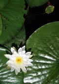
Canoeing is a way to sit still and pay attention.
|
InsightCanoeing is a way to sit still and pay attention.
|
Canoe TripsBoundary Waters:
Boats & GearBoundary Waters Gear ListWenonah Prism (sold)
|
Boundary Waters Canoe Area WildernessCampsite MapsSomeone once said he likes to go to the BWCA ranger station, get his BWCA permit, and then figure out where he's going. I tend to plan a little farther in advance than that. After I have the general area identified and a rough trip plan in place, I like to identify campsites I might like to stay at. I've collected information from several sources and offer what I've learned on this page. I've compiled information from my own observations and occasional comments from others, but for the most part it comes from the campsite assessments on the BWCA.com web site. The base data are available on the web. I use the file named bwca-camp+port-wpt.gdb, which is a Garmin database, but other formats and additional maps are also available. Many thanks to Arch Harris for providing this information. Other sources of BWCA waypoints are available, but among those I've seen this is the most useful. I've gone to the BWCA only a few times, so I haven't compiled data for a lot of different areas. Below are maps and supporting data on those areas I've visited or have trips planned for. I will be updating this page from time to time, so if you'd like me to add or change anything, please let me know. The maps show entry points, landings and campsites. The symbols are those available in my GPS (Garmin eTrex vista HCx), which is why the Entry Points show a motorboat landing; it just happens to be the most relevant symbol available. The maps were generated with MapSource, Garmin's GPS software. Sites that I don't know anything about or are just ordinary are marked with a green tent. Sites that are known or rumored to be 4- or 5-star quality are marked with a green flag. And sites that are known or rumored to be sub-par are marked with a red flag. An asterisk (*) after a site's number indicates that supplemental waypoint information is available. If I'm using my GPS, the * is a cue to look at the waypoint data. However, since my GPS can hold only 30 characters of additional information for each waypoint, the comments I've listed in the documents below are sometimes necessarily cryptic. The campsite numbers come from the BWCA.com site linked above; I believe each number is the same as the one painted on the site's latrine. Lake One - Snowbank Lake AreaHere's the map. And a PDF document showing the campsite numbers. Lac La Croix AreaHere's the map. And a PDF document showing the campsite numbers. Isabella Lake and Kawishiwi River AreaHere's the map. And a PDF document showing the campsite numbers. (The map doesn't show the Isabella River; this will be included in the next update. However, the PDF shows the campsites.)
|
Comments and suggestions welcome. Feel free to e-mail
me.
Last updated
January 23, 2010
Brought to you by Codabone Productions ©2009
